Hecate Strait
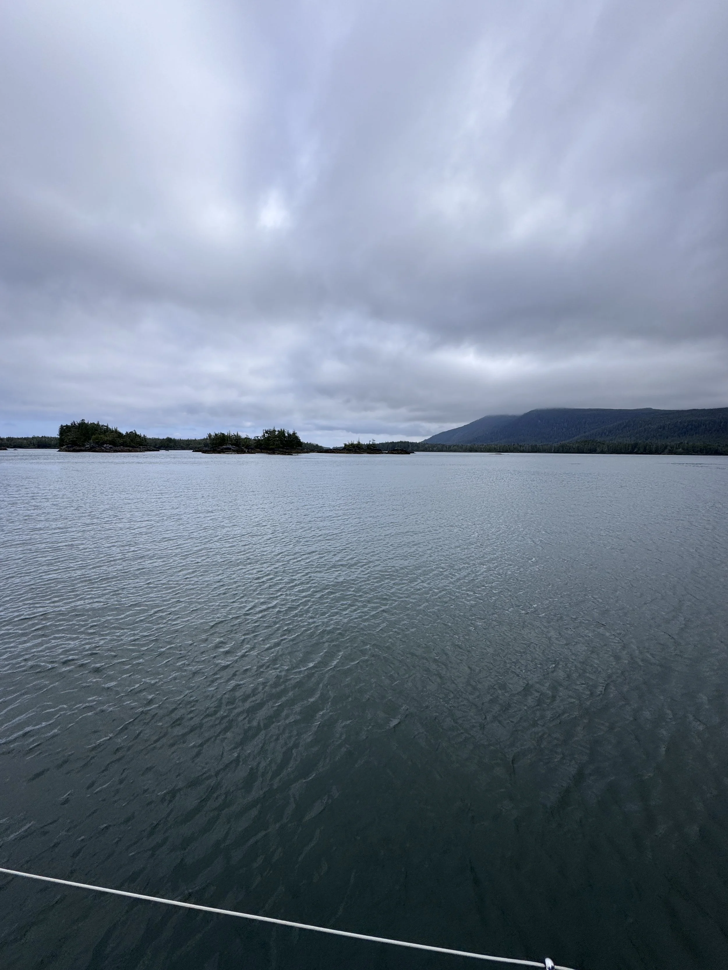
From Welcome Harbor looking at Porcher Island
Our voyage from the Broughton Islands, around Cape Caution, and up to Prince Rupert has been fantastic. We had good winds and were able to sail up Laredo Sound, Estevan Sound, Principe Channel, Petrel Channel, and Ogden Channel all the way to Prince Rupert. All of that will be the subject of another post.
We spent five days in Prince Rupert doing maintenance chores, cleaning the boat, provisioning, and resting. After a month of picking up necessities in small stores along the way, walking into Safeway was a shock. It’s as well‑stocked a grocery store as any I’ve seen—no waiting on the “weekly delivery ferry” for shelves to fill up. Prince Rupert is a gateway for any resource being extracted from Canada: coal, lumber, wood pellets, and LNG (liquified natural gas). The biggest ships in the world come and go from Prince Rupert, and that number is scheduled to increase by 250 trips a year once the Kitimat LNG facility is fully operational.
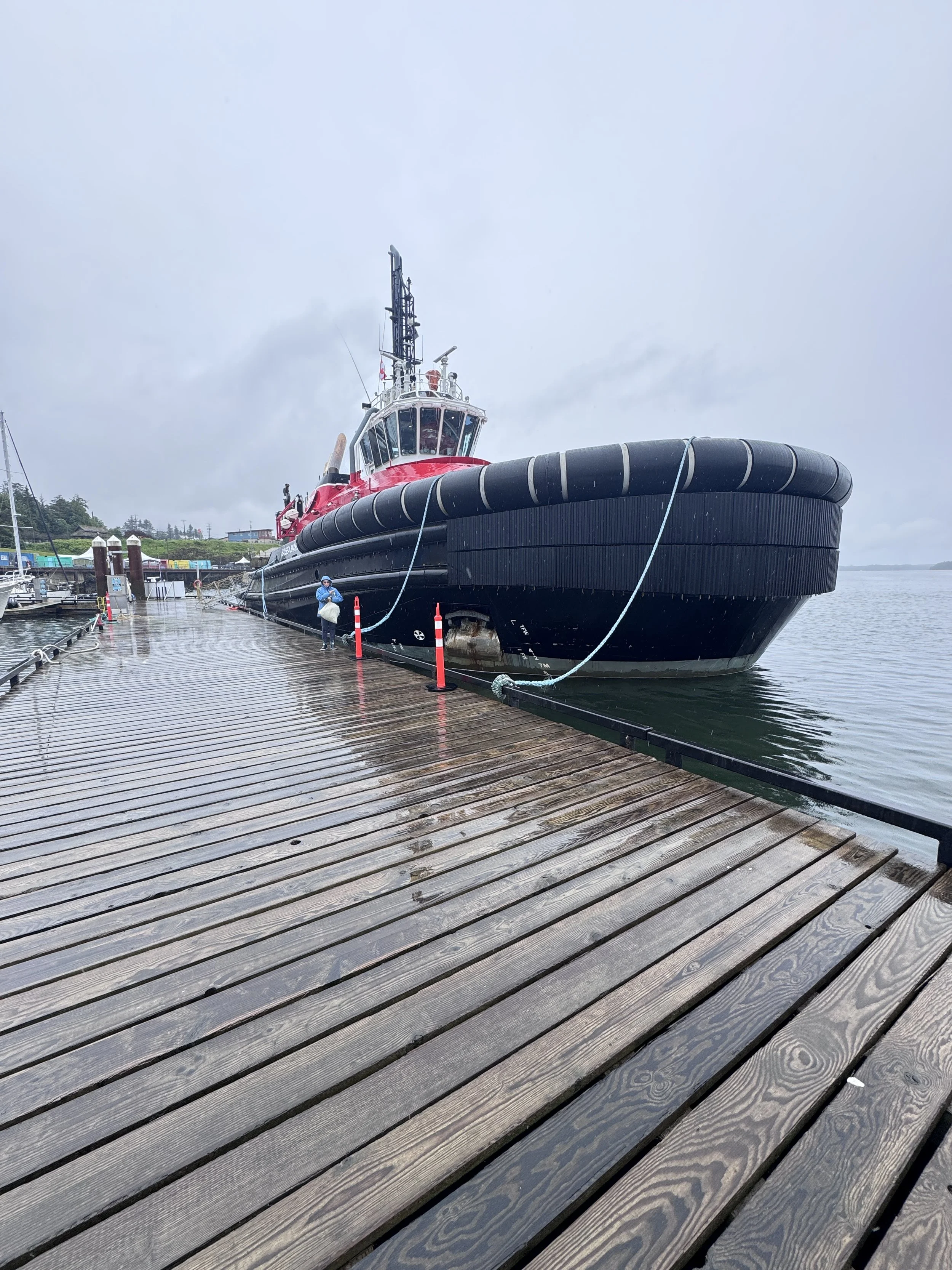
An escort tug for the tankers coming out of the Kitimat LNG facility. This boat looked gigantic on the dock but looks really tiny when escorting a tanker.
Our friends Kasey and Marjie flew in on Friday, June 26th, and we returned to a fabulous sushi restaurant called Opa Una for the second time. Saturday was a day of installing a few parts our friends had muled for us, visiting the well‑done Indigenous museum, and finished provisioning. Kasey has a friend in the Canadian Coast Guard who gave us a tour of the cutter used for rescue operations—a real treat. In the evening, we visited another Middle Eastern restaurant called Irabesque and enjoyed a great waterfront walk back to the marina. On Sunday morning, we filled up with fuel and headed to Welcome Harbor, where we planned to stage for crossing Hecate Strait.
Crossing Hecate Strait is something I’ve been thinking about since we decided on Haida Gwaii as a destination last summer. It’s the biggest body of water I will have endeavored to cross as a captain. The Race to Alaska boats caught up to us, and we’ve been watching them pound their way upwind in 25–30 knots and 4–6 foot waves for ten days. We, on the other hand, had the luxury of sailing upwind in inland waters with little to no swell. Still slow going, but pretty comfortable.
We’ve been waiting for a weather window to cross, and that day comes tomorrow, Wednesday, July 1st—10–15 knots on our stern with 1–3 foot trailing waves. Our route is intentionally north to south so both the wind and waves will follow us.
This afternoon we scoped out a narrow passage out of Welcome Harbor that would save us 5–6 miles in the morning, but it looks too tight. That means backing up our departure an hour to 4:00 a.m. It’s 60 miles to the entrance of Skidegate Inlet, where we need to cross at high slack water around 4:00 p.m. tomorrow. Averaging 5 knots, that’s 12 hours. Once inside the inlet, we’ll have another two hours to our anchorage. A toast will be in order.
Why pay so much attention to finding a mild weather window to cross Hecate Strait? I can’t do any better than to have you read this description from The Golden Spruce:
A NUMBER OF PLACES lay claim to the title “Graveyard of the Pacific,” and the west coast of Vancouver Island is one of them, but it would be more accurate if its limits were extended to include all of coastal B.C. Well over a thousand vessels have gone down here during the past two hundred years, and Hecate Strait is arguably the most dangerous body of water on the coast. The strait is a malevolent weather factory; on a regular basis its unique combination of wind, tide, shoals, and shallows produce a kind of destructive synergy that has few parallels elsewhere in nature. From the northeast come katabatic winds generated by cold air rushing down from the mountains and funneling, wind-tunnel style, through the region’s many fjords, the largest of these being Portland Inlet, which empties into the strait thirty miles north of Prince Rupert. Winter storms, meanwhile, are generally driven by Arctic low pressure systems born over Alaska, and they tend to manifest themselves as southerlies along the coast. It is because of these winds that the weather buoy at the south end of Hecate Strait has registered waves over 100 feet high. One of the things that makes the strait so dangerous is that these two opposing weather systems can occur simultaneously. Thus, when a southwesterly sea storm, blowing at 50 to 100 miles an hour collides, head-on, with a northeasterly katabatic wind blowing at similar strength, the result is a kind of atmospheric hammer-and-anvil effect. Veteran North Coast kayakers tell stories of winds like this lifting 400 pounds of boat and paddler completely out of the water and heaving them through the air.
But this is only one ingredient in Hecate Strait’s chaos formula. Tides are another; in this area they run to 24 feet, which means that twice each day, vast quantities of water are being pumped in and out of the coast’s maze of inlets, fjords, and channels. The transfer of such volumes in the open ocean is a relatively orderly process, but when it occurs within a confined area like Hecate Strait that is not only narrow but shallow, the effect is of a giant thumb being pressed over the end of an even larger garden hose. The scientific name for this is the Venturi effect, and the result is a dramatic increase in pressure and flow. A third ingredient is a frightening thing called an overfall which occurs when wind and tide are moving rapidly in opposite directions. Overfalls are steep, closely packed, unpredictable waves capable—even at a modest height of 10 to 15 feet—of rolling a fishing boat and driving it into the sea bottom. They can show up anywhere, but their effects are intensified by sandbars and shoals like the one that extends for twenty miles off the end of Rose Spit between Masset and Prince Rupert. Under certain conditions, overfalls take the form of “blind rollers,” which are large, nearly vertical waves that roll without breaking; not only are these waves virtually silent, but under poor light conditions they are also invisible—until you are inside them. If one then factors in the prevailing deep-sea swell that in winter surges eastward through Dixon Entrance at heights of 30 to 60 feet, and the fact that a large enough wave will expose the sea floor of Hecate Strait, the result is one of the most diabolically hostile environments that wind, sea, and land are capable of conjuring up.
Most sailors who survive storms do so because they orient themselves to the prevailing wind and waves, get into the flow, as horrendous as it may be, and ride it out. But on a bad day in Hecate Strait, you can’t get into the flow because there is no flow to be found; a 70-knot gust or an apartment building’s worth of water can hit you from any direction. There is no rhyme or reason; all around you, the elements are at war with themselves. Because of the manic-depressive weather and the fact that this part of the coast remains as dark and featureless as it was when Pérez came through, mariners must navigate these waters the same way a mouse negotiates a kitchen patrolled by cats: by darting furtively from one hiding place to the next. If the conditions aren’t favorable, you simply sit tight and wait—maybe for a long time. As one local veteran put it, “The worst thing you can do is be in a hurry to get somewhere.”
Gordon Pincock is an expert kayaker and one of the people who pioneered the sport in Haida Gwaii. Over the course of twenty years he has paddled the length and breadth of the archipelago, including numerous trips along the extremely exposed and isolated West Coast. On one occasion, he survived a day in 30-foot storm swells, during which he was nearly killed by a West Coast phenomenon called clapitos. Clapitos occurs when a large wave bounces off a cliff face and collides with the wave behind it, turning the sea into an aqueous trash compactor. It is hell on small craft: a 30-foot wave ricocheting off a wall will head back to sea as a 15-footer, but when it butts heads with the next 30-footer the two will merge into a 40-foot mountain of confused hydropower—over and over again. It is significant, then, that Pincock has never attempted a crossing of Hecate Strait. “Go out there alone?” he said. “In February? No way! I would never risk my life doing that, not even in the summer.”
We are crossing rested and at a time of our choosing, during the mildest part of the year. We have taken every precaution possible and Ardent is in great shape. Many people do this every year, but for us it’s a grand adventure.
Click on the “Where’s Ardent” link on our website for our current location and the time we were there. If you see us not moving for a couple of hours, maybe send Laura or me a text to check in. And if you still don’t see us moving, perhaps ping the Canadian Coast Guard with our last known position and the time we were there.
We will post an update once we arrive.